Camping And Hiking at Emery Bay Campground
You just cant hike if you don’t have a place to lay your head. A popular campground in the Hungry Horse Ranger District is the Emery Bay Campground.
The Emery Bay Campground is located on the east shore of the Hungry Horse Reservoir off of Road 38.
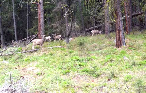
You will enjoy a variety of recreational activities, including fishing, boating, swimming, hiking, and of course exploring.
The campground is situated along the massive Hungry Horse Reservoir, which was dammed to provide hydroelectric power and flood control to the area. It is the 10th highest dam in the United States and provides a stunning backdrop.
Boating is popular on the 27,750-acre reservoir, and a native boat ramp for smaller watercraft is available. Swimming and fishing are also popular pastimes, and anglers can expect a catch of cutthroat trout and other varieties.
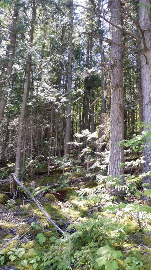
A number of biking and hiking trails begin near the campground and wind around the surrounding landscape and shoreline.
The campground offers more than two dozen first-come, first-served campsites, available for tent and RV camping. A group campsite is also available and can accommodate up to 150 guests on two separate loops.
Each campsite includes tables and campfire rings with grills. As well as vault toilets and drinking water. An on-site host is available to answer any questions about the campground and surrounding areas.
Emery Bay Campground is just 15 miles southwest of the West Glacier entrance into Glacier National Park.
 Glacier National Park is named for the glaciers that produced its landscape. A glacier is a moving mass of snow and ice. It forms when more snow falls each winter than melts in the summer. The snow accumulates and presses the layers below it into ice. The bottom layer of ice becomes flexible and therefore allows the glacier to move. As it moves, a glacier picks up rock and gravel. With this mixture of debris, it scours and sculptures the land it moves across. This is how, over thousands of years, Glacier National Park got all its valleys, sharp mountain peaks, and lakes. There are more than 50 glaciers in the park today, though they are smaller than the huge ones that existed 20,000 years ago.
 The park is unique among US parks in its relationship with the Waterton Lakes National Park in Alberta, Canada. The two parks meet at the border shared by the two countries. Though administered by separate countries, the parks are cooperatively managed in recognition that wild plants and animals ignore political boundaries and claim the natural and cultural resources on both sides of the border. In 1932, the parks were designated the first International Peace Park in recognition of the bonds of peace and friendship between the two nations. The two parks jointly share the name The Waterton-Glacier International Peace Park. Then, in 1995, The Waterton-Glacier International Peace Park was designated for inclusion as a World Heritage Site.
 Recent archaeological surveys have found evidence of human use dating back over 10,000 years. These people may have been the ancestors of tribes that live in the area today. By the time the first European explorers came to this region, several different tribes inhabited the area. The Blackfeet Indians controlled the vast prairies east of the mountains. The Salish and Kootenai Indians lived and hunted in the western valleys. They also traveled east of the mountains to hunt buffalo.
 The construction of the Going-to-the-Sun Road was a huge undertaking. Even today, visitors to the park marvel at how such a road could have been built. The final section of the Going-to-the-Sun Road, over Logan Pass, was completed in 1932 after 11 years of work. The road is considered an engineering feat and is a National Historic Landmark. It is one of the most scenic roads in North America. The construction of the road forever changed the way visitors would experience Glacier National Park. Future visitors would drive over sections of the park that previously had taken days of horseback riding to see.
 Website: