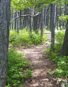
Hiking Trail: Camp Misery Trail #68
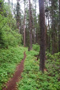
The Camp Misery trail is 0.8 miles long. It begins at the junction with Noisy Creek Trail #8 and ends at the junction with Alpine Trail #7 and provides one of the many accesses into the Jewel Basin Hiking Area. The trail is primarily open for the following uses: Hiking.
Usage is typically light, closest town is Bigfork
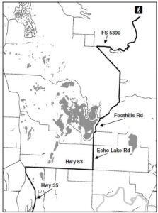
Directions:
From Bigfork, go North on Highway 35 for 2.3 miles and turn right onto Highway 83. Stay on 83 for 2.8 miles and turn left onto Echo Lake Rd. After 2.2 miles, turn slightly right onto Foothill Rd. Continue for 1.1 miles and bear slight right following the Jewel Basin sign onto Road #5392. Continue 6.6 miles to the end of the road for the trailhead.
Location
Area/Length : 0.8 miles
Elevation : 5,750 feet – 7,530 feet
 Directions:

 The Go Hike with Mike Trail Guide contains most every trail head around Flathead Lake. The guide includes trails as far north as Polebridge.


 Visiting Montana. We provide information and content for folks who are visiting Montana. Thank you for visiting our site. Many years back the Flathead Lake Vacation Guide was written to provide tourist with the information they needed while visiting Montana.
 Travel is primarily by foot with some horseback use. Mountain bikes, hang gliders, motorized trail bikes, motorcycles, three and four wheelers, and snowmobiles are not permitted. Few of the trails can be called easy. Some are especially difficult because of steepness. You should be an experienced hiker to travel cross country and should possess map reading and compass skills.
 Website: