Hiking Trail: Crane Mountain Trail #314
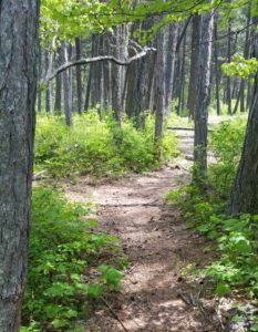
The Crane Mountain trail is 2.1 miles long (total of 3.5 miles from trailhead) and climbs about 330 feet. It begins at the junction with the Beardance Trail #76 and ends at the junction with Road #10218 near Crane Mtn Rd. From the Beardance trailhead this is one of three trails that climb up Crane Mountain. This lesser known trail starts winding up a few switchbacks through a larch/pine forest with thick undergrowth. It then straightens out and parallels Crane Creek to an old road bed. Turning left, follow the level road out to the upper trailhead. The trail is open for the following uses: hiking, horseback riding, and mountain biking.
Usage is typically light, closest town is Bigfork
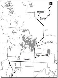
Directions:
From Bigfork, go south on Highway 35 past Woods Bay and turn right after mile marker 23, entering the Beardance trailhead parking. The trailhead is on the east side of the highway.
Location
Area/Length : 2.0 miles
Elevation : 4,370 feet – 4,700 feet
 Directions:

 The Go Hike with Mike Trail Guide contains most every trail head around Flathead Lake. The guide includes trails as far north as Polebridge.

 Website: