Recreation Permits in the Flathead and Kootenai National Forest:
Recreation Permits are not required for hiking or camping on the Forest. The forest is open to the public all year except when extreme conditions threaten the forest (i.e., high potential of catastrophic fire, winter snow or extreme bad weather)
Permits when Camping and Hiking in National Parks
The interagency America the Beautiful – National Parks and Federal Recreational Lands Pass is honored nationwide at all Forest Service, National Park Service, Bureau of Land Management, Bureau of Reclamation, and US Fish & Wildlife Service sites charging entrance or standard amenity fees. The Interagency Annual Pass is $80 for a year pass and is available to the general public.
Tribal Conservation Permit in Montana
CSKT Tribal Conservation permits when Camping and Hiking in the Mission Mountain Tribal Wilderness:
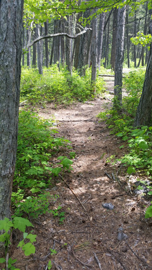
The Mission Mountains Tribal Wilderness is located on the western slopes of the Mission Range. The area covers approximately 91,778 acres. It is roughly 34 miles long and five miles wide. Elevations range from four thousand to nearly ten thousand feet.
All recreational activities on Tribal owned lands require a non-member person over the age of 11 to purchase a Tribal Conservation Permit. All non-members must have on their person; whenever engaged in recreation activities on Tribally owned lands of the Reservation, a valid Flathead Reservation Use Permit, and any additional bird, fishing, or camping stamps as required. Certain Tribal campgrounds and recreation areas may have special regulations, which are posted, on site.
NOTE: Recreation Permits must be purchased in person initially from a retail outlet/Reservation Permit vendor to register. After that first registration you can purchase online. Reservation Permits are available on the internet at http://app.mt.gov/Als/Index
Pablo, MT at Zimmer Tackle
Plains, MT at Plains Service Center
Polson, MT at – CSKT, DFWRC, 406 6th Avenue East and Wal-Mart
Ronan, MT at Westland Seed
St. Ignatius, MT at Allard’s Stage Stop
Off-Road Motorized Vehicle Use, Motorcycles, ATVs, and Snowmobiles: Operating motorized vehicles off of authorized roadways is prohibited. For this purpose an authorized roadway is defined as a route specifically built as authorized by the Tribes for the purpose of motor vehicle use.
 Fees are charged during the summer (mid-May to late October). The Range is part of the U.S. Fee System and accepts Golden Passes and Federal Waterfowl Stamps. Pay fees at the Visitor Center. Camping is not allowed and the Range is closed at night.
 Glacier National Park is named for the glaciers that produced its landscape. A glacier is a moving mass of snow and ice. It forms when more snow falls each winter than melts in the summer. The snow accumulates and presses the layers below it into ice. The bottom layer of ice becomes flexible and therefore allows the glacier to move. As it moves, a glacier picks up rock and gravel. With this mixture of debris, it scours and sculptures the land it moves across. This is how, over thousands of years, Glacier National Park got all its valleys, sharp mountain peaks, and lakes. There are more than 50 glaciers in the park today, though they are smaller than the huge ones that existed 20,000 years ago.
 The park is unique among US parks in its relationship with the Waterton Lakes National Park in Alberta, Canada. The two parks meet at the border shared by the two countries. Though administered by separate countries, the parks are cooperatively managed in recognition that wild plants and animals ignore political boundaries and claim the natural and cultural resources on both sides of the border. In 1932, the parks were designated the first International Peace Park in recognition of the bonds of peace and friendship between the two nations. The two parks jointly share the name The Waterton-Glacier International Peace Park. Then, in 1995, The Waterton-Glacier International Peace Park was designated for inclusion as a World Heritage Site.
 Recent archaeological surveys have found evidence of human use dating back over 10,000 years. These people may have been the ancestors of tribes that live in the area today. By the time the first European explorers came to this region, several different tribes inhabited the area. The Blackfeet Indians controlled the vast prairies east of the mountains. The Salish and Kootenai Indians lived and hunted in the western valleys. They also traveled east of the mountains to hunt buffalo.
 The construction of the Going-to-the-Sun Road was a huge undertaking. Even today, visitors to the park marvel at how such a road could have been built. The final section of the Going-to-the-Sun Road, over Logan Pass, was completed in 1932 after 11 years of work. The road is considered an engineering feat and is a National Historic Landmark. It is one of the most scenic roads in North America. The construction of the road forever changed the way visitors would experience Glacier National Park. Future visitors would drive over sections of the park that previously had taken days of horseback riding to see.


 Website: